By Nick Sodano, Editor
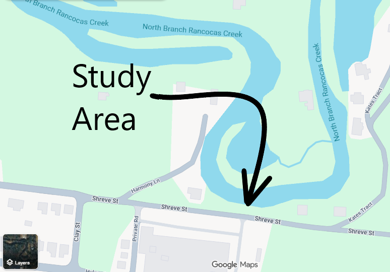
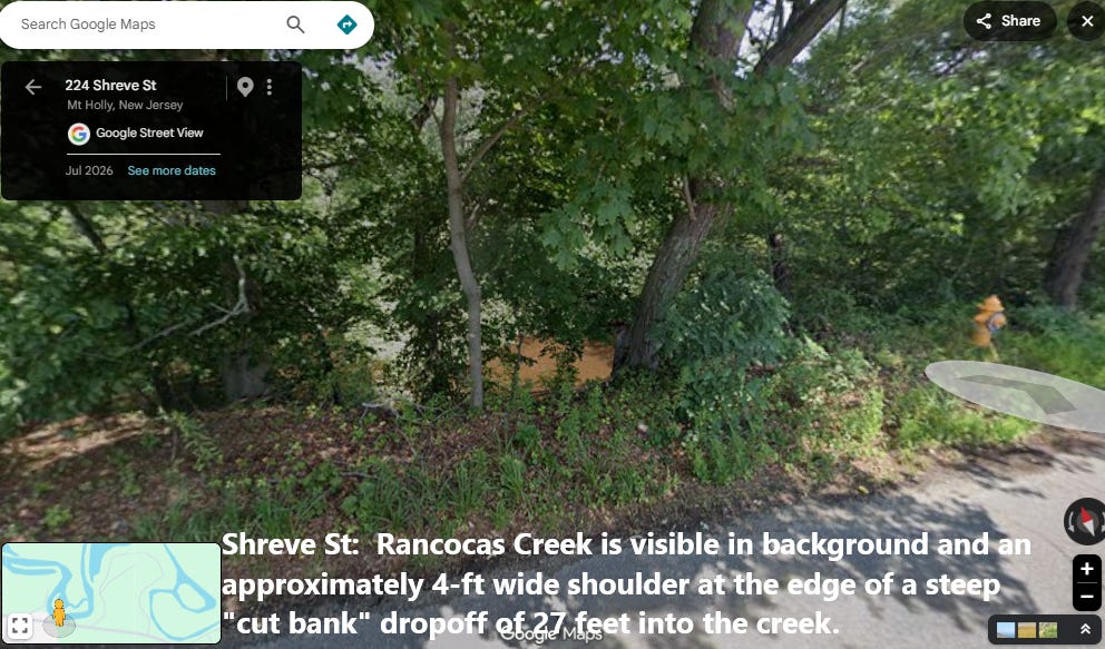
SUMMARY: During 2022, this writer produced an assessment of the structural threat posed to a section of Shreve Street, east of Clay Street. At that location, there is a “cut bank” of the northern branch of Rancocas Creek. Shreve is poised at the top of this stream bank, some 27 feet above the Rancocas Creek. Some portions of the bank form a vertical “cliff” while many sections have a strong slope that is a challenge to climb and some areas with well sorted, loose sand. The erosion that caused these features is continuous and “cutting” shoreline which is actively collapsing into the creek. This will eventually undermine a section of Shreve Street. What is not known is how long this will take, which is why Twp Manager Josh Brown was warned of the problem in 2022 and asked to have our township engineer Alaimo Associates make an assessment of the rate of erosion and present suggestions about what actions should be taken, if any. It is known that Mr. Alaimo visited the location, but what conclusions he reached about the stability of the cut bank and any potential courses of action are unknown to The Reporter.
While information about Mr. Alaimo’s visit is unknown, The Reporter has a curt November of 2022 email from the Township Solicitor alleging that “constant” questions caused unwelcome township professionals costs to Mount Holly:
“The residents of the Township should not be paying their professionals to constantly handle the concerns and questions of any one resident unless authorized by the Administrator. You can interpret my ask anyway you like, but the request could not have been clearer. Again, thanks for your cooperation.” Tom Coleman, Solicitor
Coleman’s exaggerated frequency of communication with Alaimo notwithstanding, it was not clear how my email to Mr. Alaimo, alerting him to the issue, would force him to “handle” a concern since, because as Coleman notes, only the Administrator has the authority to order actions on behalf of the township.
The Reporter did come into possession of an email between Manager Brown and Alaimo which made clear the actual concern: Alaimo had a discussion with Brown about a field inspection which would generate a bill. Brown suggested that the inspection could wait until it occurred in the context of a pending planning board matter. More on the planning board matter below.
WHAT IS A CUT BANK?
If you have ever canoed or kayaked the Rancocas, you will have almost certainly seen a cut bank, where a sharp meander causes the river to undercut shorelines where a topographic high happens to be adjacent to water. In some instances, these “cut banks” create an impressive “cliff” where unfortunate trees dangle until they eventually fall into the creek.
In October of 2022, I conducted an inspection of the cut bank on Shreve Street and observed a number of signs that the river bank holding the road up had been severely eroded. One sign was a formerly upright tree which lost so much supportive soil that it fell to a 20 degree angle from horizontal.
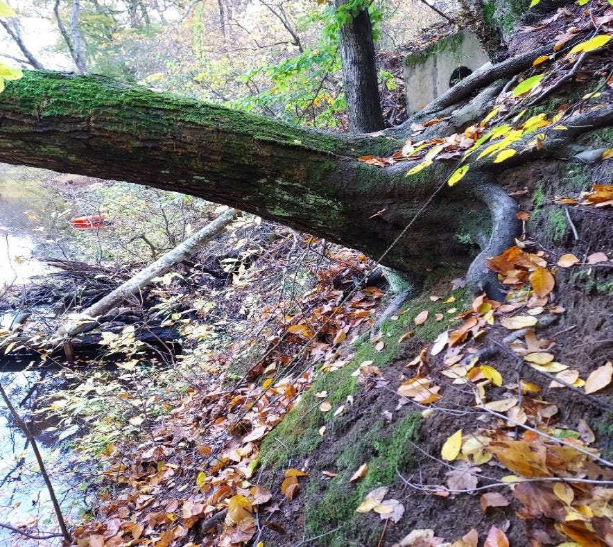
Another sign was a large section of concrete, which was poured by the township years ago, lost soil under it and fell into the creek near a storm outfall it was meant to serve.
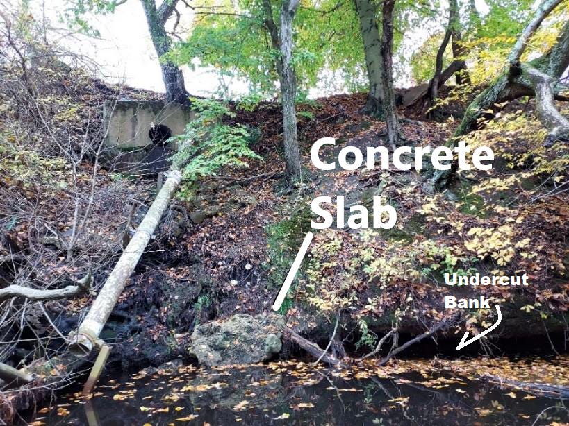
Other signs were the near vertical sections of shore line, especially adjacent to the stormwater outfall and street, along with the undercut soil where the water meets the bank [see image above].
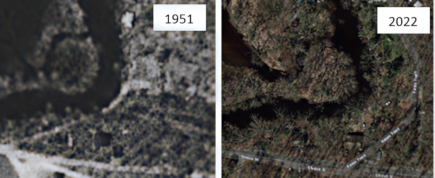
Finally, there is the aerial photography which shows a section of “Kate’s Tract” Road that was lost to the creek and re-aligned in its current orientation away from the creek. Notice two houses - the road in front during 1951 and behind them in 2022.
HOW DID THIS COME TO LIGHT?
A property to the south of Shreve Street came to the planning board during 2022 which involved Dean Demolition’s practice of bringing asphalt and concrete to a lot and crushing it in a zoning area called “Limited Industrial”. This caused a lot of noise and dust to which nearby residents objected. The crushing activity had already been rejected by the zoning officer, but the landowner appealed that decision to the Planning Board and its professional engineer, Alaimo Associates.
Alaimo demanded a series of studies from the landowner to demonstrate that the crushing activities met the definition of a Limited Industrial activity. The landowner chose not to proceed with their appeal.
Note: the delivery of concrete and asphalt to the site involved extremely heavy trucks passing the location of the cut bank. This caused vibration to a slope that was clearly unstable and not suitable for such traffic.
WHAT CAN BE DONE TO MITIGATE ANY PUBLIC SAFETY HAZARD?
Town council may want to re-inquire with Mr. Alaimo as to what assessment he had of the creek bank and road stability back in 2022, and what suggestions, if any, he had with regard to stabilization or re-alignment.
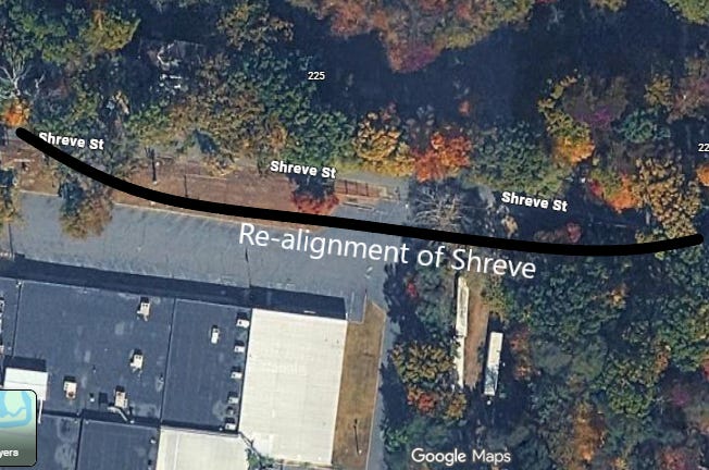
In its current configuration, one very expensive road stabilization method would be sheet piling, which is unlikely in terms of Mount Holly’s budget. There may be federal or state funding for such a project, but the easiest and least expensive measure would be to shift a small portion of the road 20 feet to the south.
If indeed our engineer agrees that the current cut-bank situation presents a public safety threat to the road and the drivers who use it, the best method to move the road would be to make an reasonable monetary offer to buy that land from the current owner without the threat of eminent domain. Luckily, that section of private land is mostly lawn adjacent to a large parking area and the facility seems unused at the current time. If our engineer agrees that re-alignment is a good idea, now may be an ideal time to make an offer.